Day 25 –Crossing the Continental Divide, Logan Pass
- Aug 21, 2016
- 9 min read
Date: Monday, 8 August 2016
Time on Bike: 4:49:01
Total Travel Time: 7:36:57
Miles Covered Today: 56.60
Total Trip Miles: 1,622.2
Average Speed: 11.7, Maximum Speed: 31.1
From: Rising Sun, Glacier National Park, MT
To: Columbia Falls, MT
(Uploaded on 21 Aug 2016)
Today is the day!
Going-to-the-Sun Road. Logan Pass. 6,646 feet.
It has been on my mind now for 32 years.
This will be a long blog post. As it is a long climb… and an even longer downhill!
For those of you who are new to my blog and didn’t fumble all the way back to the first post, some context might be in order. I was to have cycled cross country in 1984 to get from the East Coast to the West Coast to see the Olympics in LA. It ended up being a 4,000-mile plus bike trip... but I did not actually make it “cross country”!! I learned in Chicago that I needed to get to Seattle sooner than I had planned to bike the last leg from Seattle to LA with a buddy to get there in time for Opening Ceremonies. So I flew from Chicago to Seattle. This trip in 2016 is to make my 1984 trip “complete”! Got it??
As an aside, interesting that the Summer Olympics in Rio just started. Haven’t seen one minute of it. Doubt I will see anything on TV until I have rolled into Anacortes, WA, the final stop of Adventure Cycling Association’s Northern Tier Bicycle Route. No time. No energy. And usually, no TV!!
I was up early today. Slept OK. Logan Pass, all 6,646 feet of it was, however, on my mind. It was a glorious morning at Rising Sun.

I was a little concerned with the wind whipping down the valley. Note the flag… a headwind of course. Argggggh!
I needed a good breakfast this morning. Waited for the Two Dog Flats Grill to open at 6:30 AM. Ordered a plate of French Toast and hot tea. Earl Grey is my morning choice. Came back to the room, checked my gear, double checked my food supplies for the day, and loaded my bike on the Prius so Bunny & Woz could run me back up the road to Saint Mary Visitor Center at the eastern edge of the park. It was time to do the deed!

As you can see, I got photo bombed by some yo yo!
I was wearing my good luck jersey. Every day I wore my Israel Guide Dog Center for the Blind / Can Velo jersey during training I did great. I had saved it special for this day!
I had 19 miles of climbing to Logan Pass. I was guessing 3-hours of climbing, with only a few rest stops.
The wind had really picked up. As we hit the road, I could see white caps on Saint Mary Lake!!! Waves & white caps!! Holy crap! I was already running a little late. So how would that headwind slow my progress? I needed to hit the real climbs sooner rather than later.
You see there is a time cut off. In summer, during heavy tourist season, sections of roads get closed to cyclists between 11 AM & 4 PM.

There is that 10-mile section of road that I needed to clear before 11 AM from Sprague Creek to Apgar Visitor Center. I was worried I wouldn’t make it...
I told Bunny to stop, turn around, and go back to Rising Sun. Doing those extra miles didn’t matter if that stiff headwind made me miss the road closing!
We returned to our hotel room. I loaded the Prius up with all our stuff as Bunny & Woz were going to leave when I did and take a longer route to get to the other side of the mountain. Driving on narrow mountain roads with sharp drop-offs is not Bunny’s idea of fun! For her it was a 110+ mile trip. I “only” have 50 miles to get to West Glacier, MT. Unfortunately, that meant I would not be able to celebrate my achievement up at Logan Pass with Bunny until I saw her again much later in the day in West Glacier.
I left the parking lot at Rising Sun. It was already ~8:30 AM! Took a right on Going-to-the-Sun Road, and… bamb. A stiff headwind. Not only was I starting my climb, but I had to deal with this fracking headwind too. I should have forgone breakfast at Two Dog Flats Grill and gotten out earlier in the day. Too late now...
I had a really hard time getting into my rhythm on the lower slopes. Felt tired. Legs were spinning but felt no power. I could get out of the wind on some sections of road. I took more breaks than I expected.
Not a great shoulder either, but little to no traffic this time of day. Until I got one car that just would not pass me. I do not ride in the gutter. I am 1 to 2 feet into the roadway. I want you to see me!
I eventually got a little squirrelly holding my line in such a low gear with 5 cars behind me. The rule is you pull over at that point. I swung all the way over and crossed the road to the left to Saint Mary’s Falls. This is where the climb started in earnest. Time to regroup. I got out some food. Drank some sports drink. I worked on getting my head screwed back on and soon rolled out again.
Now it is clicking. Feeling much better. Spinning my pedals in circles rather than squares. Actually feeling good. I got this! I staked out my part of the road and moved up the climb.
But my slow ascent has at least allowed me to take a ton of pictures this morning!! I hope you can appreciate what I was seeing/experiencing in the following images.


Last night I had used some wire ties and my iPhone ear buds to find a way to secure my iPhone to my front bike bag. I wanted time-lapse video of my climb. Maybe not as stable or level as I would like, but you get what you pay for!! At Jackson Glacier Overlook, I started recording video on my iPhone. You will see it later.
Jackson Glacier is one of the approximately 25 glaciers remaining in the park today. There were 150 in 1850! And by 2030, this one is expected to be gone.

The vistas were just breathtaking. And with my slow ascent by bike, every pedal stroke was a treat for the eyes. I just needed to remember to look at the road every once in a while!!


BEAR! Finally, a Black bear. Bunny was so worried that I would encounter a Black Bear today. She was right!!
I knew something was up when the road was clogged with vehicles stopped in both directions and everyone looking up the slopes! I weaved my way thru and I too finally stopped. What’s up I asked. I was directed to a mama Black Bear (supposedly with a cub, that I never saw!) up the hill rooting around for something. As she dug, rocks tumbled down the slope to the road. I had my good camera with me as my iPhone was on time-lapse video duty. This is the best video I could get! BEAR!!
The Logan Pass Visitor Center was now in view! My goal was in sight.
There was still a little more climbing to be done… and pictures to take!


Mountain Goats?? Are they talking about me??????


The woman in that picture above offered to take my picture. I quickly agreed!

And then, the Continental Divide! It was sweet.

The top was much more crowded today than yesterday.

Those red vans with the open roofs are just way toooooo cool!

I had been leap frogging this large group of kids for the last few miles of the climb. They were on a 400-mile bike trip and Logan was the highlight so far they said. I would see many of them on the way down!

It had taken me almost an hour longer to climb from Rising Sun as I had estimated. All those stops at the lower elevation didn’t help me stay on track. But really, who cares? I won’t ever do this again by bike. I now figured I would not beat the road time closure, so that took some of the pressure off. I could now descend as slow as I wanted... and enjoy it.
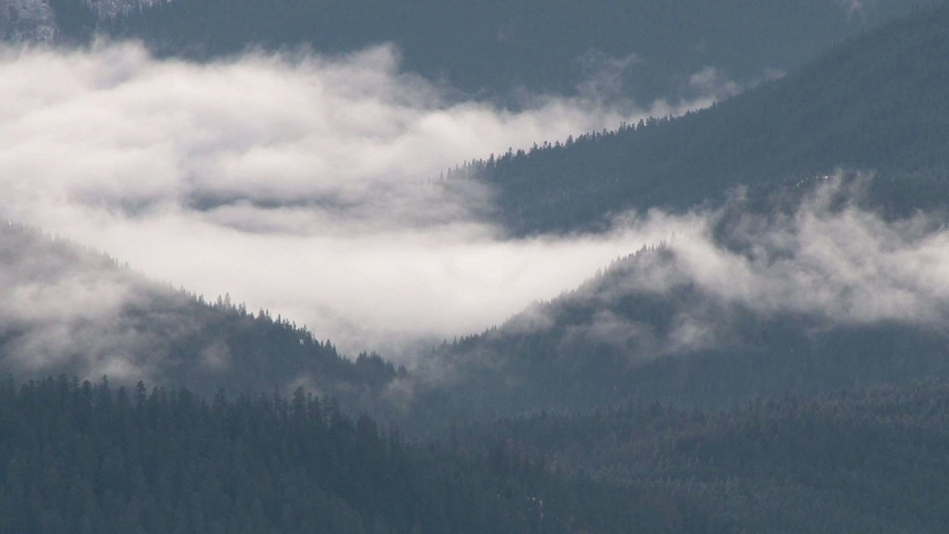
Clouds were rolling up over the side of the mountain that I would now need to descend. And I just love to see signs like this! A 6% downhill grade for… 11 miles!!!!! Wheeeeeeeeeee!

It was crazy cloudy at times.

But the lower I got, the less cloud cover.


I was breaking a lot. A bicycle can actually descend quicker than a car. And they were getting in my way!
Then my front break got stuck. The nut that holds my mirror on had come loose from the vibrations and was lodged inside the break handle. I pulled over and had the tools on me to put it back together! I was on a roll!
Around The Loop (we stopped there yesterday), I have a bee somehow fly onto my neck between my helmet and rain jacket and bite me. Mind you, I am going downhill 25 to 30 MPH. How is that even possible??? OHHHH!!!!

Traffic was heavy in both directions now. I had to constantly break for cars. I actually needed to pull over a few times to rest my fingers as they cramped up from breaking!?!?
I cycled past the appropriately named Weeping Wall!

It is hard to capture the grandeur and beauty in pictures, even in panoramic shots.

There is a short tunnel on the way down as well. I am passed by those damn kids again!!! :)

The road flattens out.

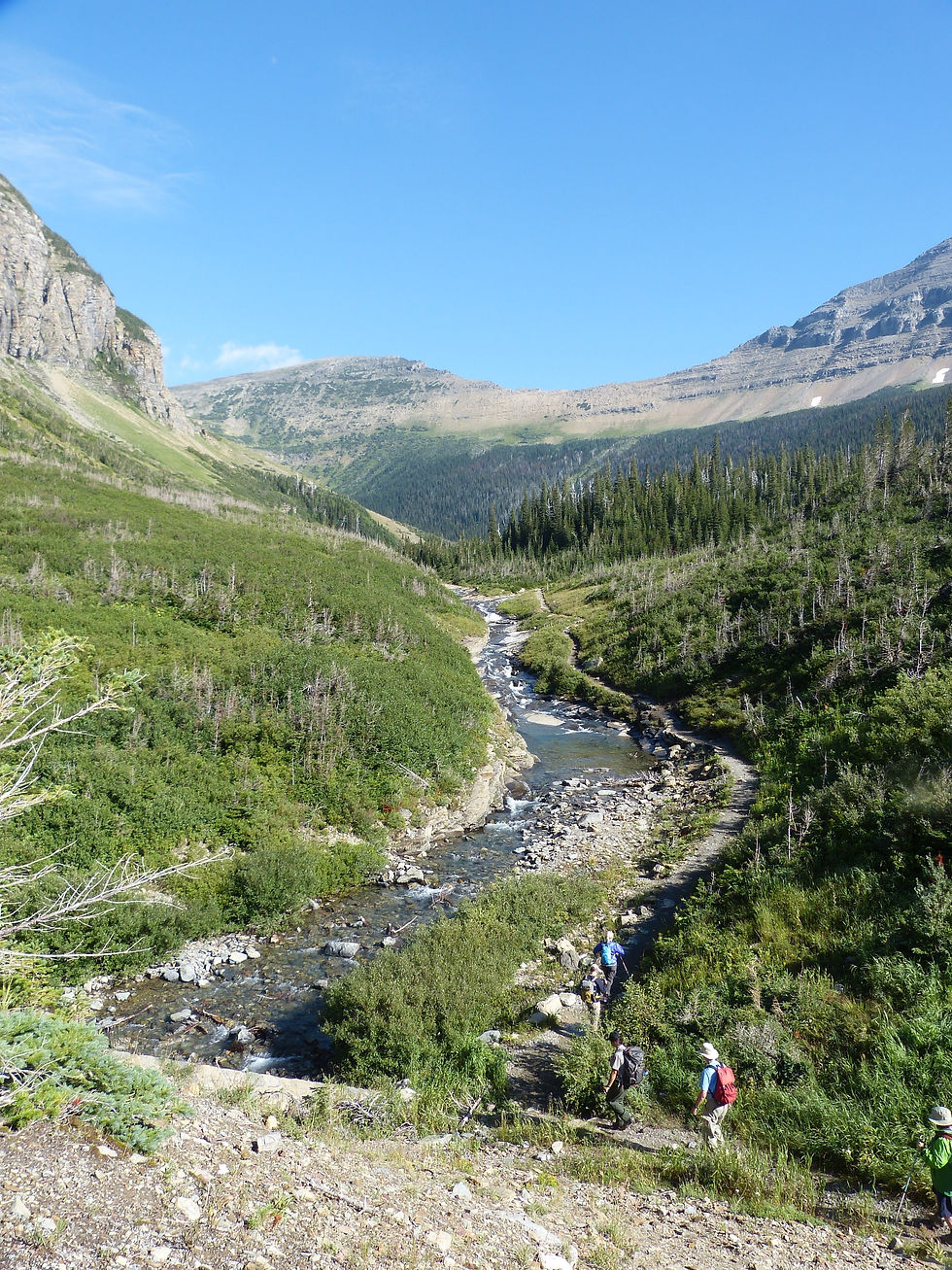
And I suddenly found myself in the valley floor below following McDonald Creek.

I started riding with those kids again...

And we all realized we have long missed the window to bike all the way to West Glacier. The roads are closed to cyclists. I will have to wait for a shuttle bus and load my bike up to get through that section of road. And that is what I do!

I unhitch my bike, load my bags back on my bike and ask a cyclist doing the same how far away West Glacier is. He says a few miles at most. He too has done Logan today. We talk for a minute or two. His name is Carl. I will see him again!
I unfortunately have to leave Glacier National Park…

My best, best, best day of my bike trip so far. How can you top a 32-year old dream?
And what a huge difference between the eastern slopes and the western slopes of the Rockies. Here on the western side, we have… trees!!!! It is green! And… AT&T. I now actually have cell coverage. Finally! But we’ll see how long that lasts!! Let me repeat again, AT&T sucks!
I find Bunny & Woz at the school where we planned to meet. Bunny has been without cell coverage on her roundabout loop most of the day. I am like 2 to 2.5 hours late. She has been worried sick while I was having a blast. Being wife & a sag wagon driver is hard!

BTW, as I unpacked my front bag to replenish my (exhausted!) food supplies that same evening, I found two notes from my dear wife in my bag. One congratulating me on my feat, and the other giving anyone who found my mangled, dead body by the side of the road her contact info that she was waiting for me!!!


It was a glorious, surreal day. Not often in life do you get to fulfill a 32-year old dream!
But my day was not done. I had another 20 miles or so to get to my final destination of the day, Columbia Falls, MT.
Adventure Cycling Association sure picked a nice route. I left HW 2, that I have been traveling on for days it seems. I didn’t even mind the lack of asphalt!

I crossed the Flathead River. A lot of rafting, canoeing , and relaxing. I wanted to go jump in!

Nice, wide shoulders. Little traffic. Mountains in the background. A fitting end to a great day!

Bunny was hanging out at Subway in Columbia Falls. She struck up a conversation with Joanie who happened to spot Woz sitting in the back seat. Joanie is a wild animal trainer (yup, you read that right--like wild tigers). We meet all types of interesting folks on the road which makes our trip quite enjoyable!

I met Bunny & Woz close to the Depot Park in Columbia Falls, MT.

We drive to our hotel in Kalispell, MT. There is a hot tub at the hotel. Nice!!
I had the best Italian food I have had on the trip so far! A very cool, hip town.

It has been a big day for everyone!! Woz is plain exhausted.

How can I top this one????
Oh, oh, oh.... the video I took in time-lapse of my climb from Jackson Glacier Overlook to Logan Pass.
I wore my heart rate monitor today to see how I was doing. Even though I didn't feel great early in the day, I must be in pretty darn good shape as I never went over the Red Line and was only ~13 minutes in the Anaerobic range!

And if you have any patience left for a few more images, here are a few more that I wanted to share...


Comments