Day 7 – Wasted Miles = Wasted Energy & What tree?
- Jul 23, 2016
- 6 min read
Date: Saturday, 16 July 2016
Time on Bike: 5:36:22
Total Travel Time: 8:59:56
Miles Covered Today: 67.28 (most so far in one day!)
Total Trip Miles: 370.7
Average Speed: 12.7 mph, Maximum Speed: 23.9 mph
From: Bangor, WI
To: Bass Camp Campground, outside Minneiska, MN
(Uploaded from Fargo, ND on 22 Jul 2016)
OK… I know I am a week behind on my posts. So fire me!!!!
Our room at the Motel 6 was on the second floor, so we only brought up the stuff that was on the cargo carrier (e.g. nothing from inside the car). So loading back up this morning wasn’t too much of an ordeal. Our hotel was across the street from this statue welcoming visitors to La Crosse, WI. The flags were at half mast. So many incidents of Police Officers killed in the line of duty recently I am not even sure which one it was for…

I had a hankering for meat this morning, so we did our first McDonald’s for breakfast. Steak, egg & cheese on a bagel. It was greasy… and good!!!!

Drove the 15 miles or so to Bangor to pick up where I left off on yesterday’s ride. On my bike by 9 AM. Still on the La Crosse River Trail. Take my first break of the morning where the La Crosse River Trail meets the bike trails in the city.

And guess what? I find I have cell service!!!!!!!!! Call Bunny and she tells me I am only 3 miles away.
But this might end up being the longest & slowest 3 miles of my life!
I almost wipe out on the ruts, loose gravel, and sand that is the trail on a descent from a pedestrian overpass crossing a major highway. I am so proud of myself and my exceptional bike handling skills! Will need them again later that morning.
I found myself leaving the trail and dumped onto a street that… is TOTALLY torn up!
No signs. No info. I have no idea how to proceed thru this crap. I pick up my bike and walk over the dirt to the closest side street. Google Maps wants me to turn around and ride on the torn up street I just left. I head out in a different direction hoping Google Maps will recalculate. But no… Google Maps brings me back to that same torn up street. Arhgggggg!
I use my compass and try and figure out a workaround. I soon find a bike path and take a chance it is going in the right direction. I soon pass the Motel 6 we stayed in last night. Huh?????? I know that was in the opposite direction of where I wanted to go.
Bunny texts me that I am now 6 miles away…
I try the Apple App Find Friends and that seems to get me going in the right direction. I meet an older couple (what does that mean anymore???) on their bikes and I explain to them that I want to get to State Street in Riverside Park next to the Mississippi River. They give me very detailed instructions. Too detailed it seems.
At a certain point, I lose the bike trail they have told me about. All the locals I ask don’t have a clue. I meet some tourists and they know how to get me to Riverside Park!
By now, I have been trying to get to Bunny for over an hour… 3 miles? Yeah, right!
So I am hauling ass on this bike trail when I hit a sharp bend. No warning sign. No sign at all! I start to brake, but see sand on the apex. I can either lay my bike down (with me on it!!!) to stop or… run off the trail. In a flash I decide to run off the trail and aim for a bush. What I didn’t know is that there was a downed tree behind that bush.
BAMB! CRASH!
I get up off the deck. No cuts or abrasions. The bush was kind. But my left drop of my handlebar has been badly bent. I wrestle my bike out of the bush & out from under the tree.

I don’t even want to open my front bag to look at my digital camera. My cell phone is in a case over my handlebars. It is OK.
I am within sight of the park. I coast in. Finally, the Mississippi River!
Bunny, Woz, and I celebrate our achievement and savor the moment.


We have a mini-picnic right there. But eventually I need to get back on the bike. But it is all exciting as I get to cross the Mississippi River!!

I leave La Crosse, WI and after crossing the Big Muddy enter La Crescent, MN. Another state!!

I am so excited to finally get on the Adventure Cycling Northern Tier Bicycle Route. All this travel from Chicago was winging it to get to this point. I now have detailed maps (one inch = ~4 miles!!) of the route I will take all the way to Anacortes, WA (north of Seattle).
But, I can’t find the fracking route. The first local I ask tells me I am on the wrong side of the Mississippi. Wrong! After speaking to numerous locals at a gas station, I am more confused than ever exactly where I am on my map.
Finally, a cyclist rides past. I know he will know. He has never heard of the Northern Tier Bicycle Route (!!!!), but thinks it is on the main road north. The numbers don’t match what I am looking for, but I didn’t care anymore. I wanted to get moving.
I do find my route!
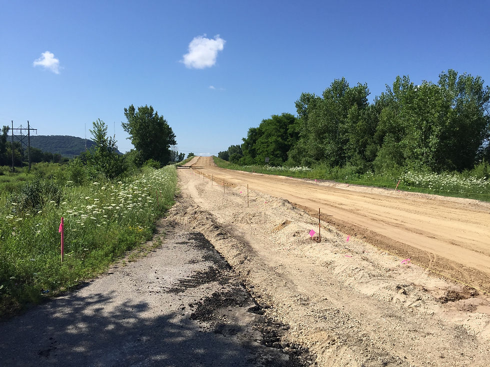
A few miles up the road, according to detailed route instructions, I am looking for a stoplight with a trail at a white fence. But there is a major construction project going on and no stoplight to be found. After cycling around for a while, and even heading down to the river in hopes of spotting the trail (I did however get to see one of the Army Corp of Engineers locks!!! – see pic below), I get back on what I think is the same road I got off of.

Why are people honking at me? I am as far to the right of the shoulder as I can get. Enough already!
Then I see a sign that I am on I-90. Oh… no wonder they are honking at me! Knucklehead. I get off ASAP. Find the route and continue to Homer, MN to meet up with Bunny & Woz.
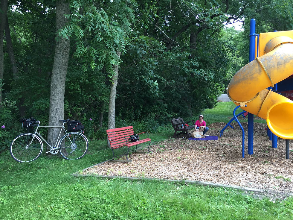
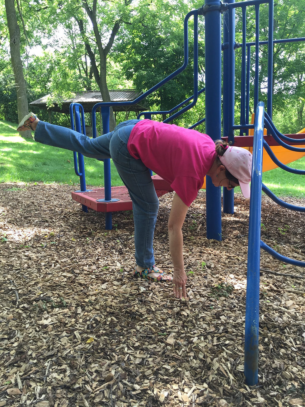
Bunny is doing a lot of sitting around waiting. She tries to keep limber and works on her balance and stretches where ever she can.
Our next stop was at a WalMart in Winona, MN. We bought a roasted chicken & salads! Yum!

Bunny wanted to stay at a hotel in Winona. I wanted to push on and stay at a private campground near a State Park. As you would expect, Bunny was right, we should have stayed in Winona!!
Most of the afternoon, I followed 61 North that hugs the river.

But... I didn’t take enough water with me heading out on a hot afternoon for that last 12 miles. Not only did I get dehydrated, but I bonked. Rookie mistakes. I stopped at a house with a lot of cars and action & asked permission to fill my water bottle. There was a company party going on and they invited me to join in. I just wanted water!
I arrived at the Bass Camp Campground, south of Minneiska, MN. Bunny was already at our campsite. I was escorted to our site by a woman named Della on a Club Car.

Dinner was the first order of business!

It was pretty full for the weekend. Even though there was a 10 PM quiet time rule, those damn young kids like to party, even if it is a campground. There were lots of very loud fireworks. Leftovers from July 4th I guess. Woz was confused but not scared. After a little reassurance, he settled in quite nicely even though the shenanigans continued for quite some time. It started to rain at about midnight and that quieted everyone down.
But by 1 AM, there was a lightning and thunder show like I have never seen. It lasted until about 5 AM. In a tent, lightning looks like it is daylight! Needless to say, none of us slept well that night. Not ever Woz...

Bunny wins the argument about camping versus hotel stays. She also says finding the bathroom in the pouring down rain is not her idea of fun. We will only camp when there are no other options! Promise!
Some other pictures from the day.


Woz checking out the Mississippi at the campground
Comments